
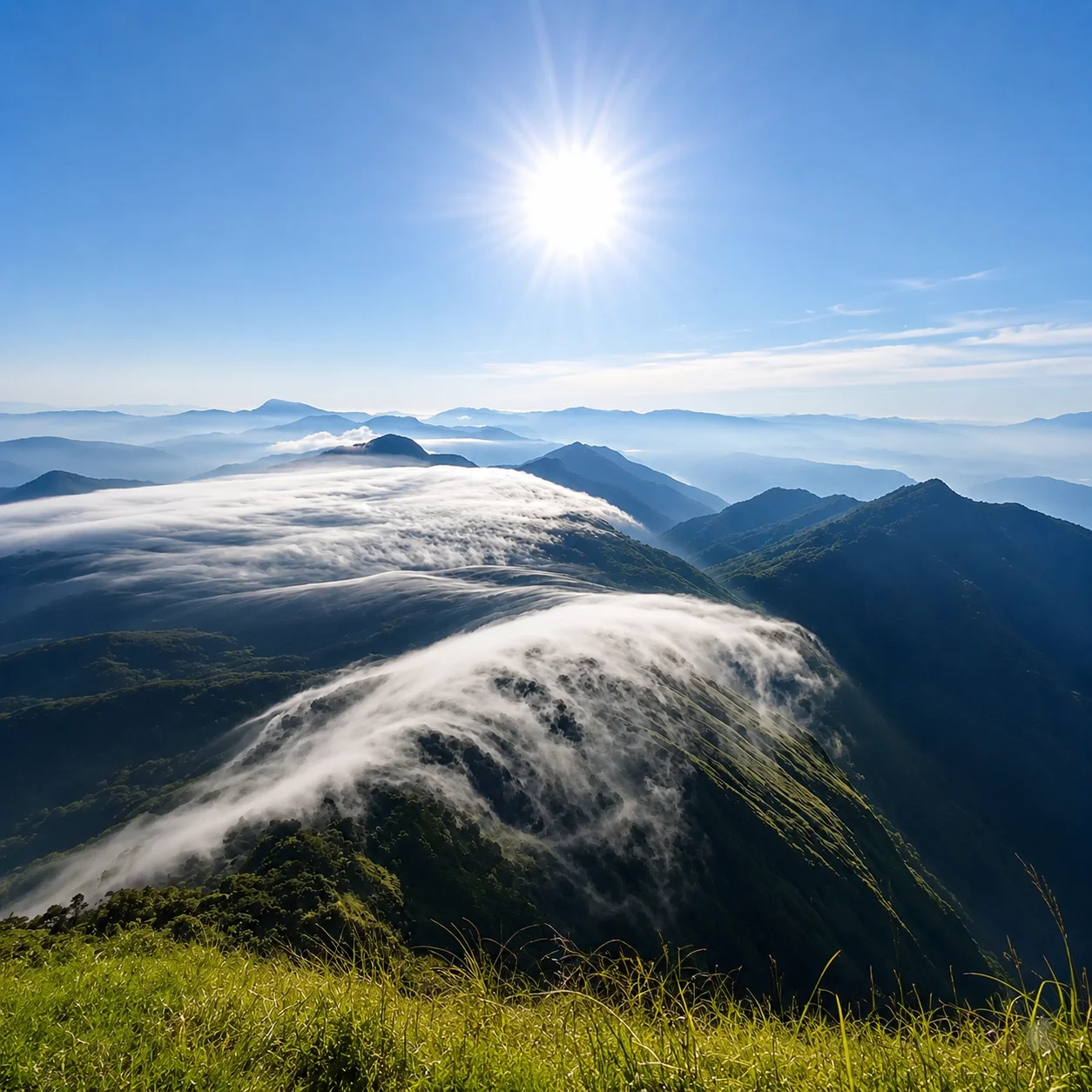
Exploring Munnar Beyond Tea Gardens: Scenic Routes, Villages & Highland Landscapes
Into the Misty Highlands of Munnar
Munnar is often introduced through familiar images, rolling tea plantations, mist-covered hills, winding mountain roads, and cool weather retreats in Kerala’s high ranges. While these landscapes remain an important part of its identity, Munnar is far more diverse than the typical hill station experience many travellers encounter during short visits.
Beyond the well-known viewpoints and tea estates, the region unfolds through multiple scenic routes leading toward forest-edge villages, wildlife corridors, high-altitude farming communities, dry mountain landscapes, reservoir valleys, and cultural transition zones between Kerala and Tamil Nadu.
Each road around Munnar offers a completely different atmosphere. Some routes move through plantation-covered highlands and cloud forests, while others descend into sandalwood regions, ecological reserves, quieter agricultural settlements, and lesser-explored mountain landscapes shaped by local communities and changing terrain.
Rather than experiencing Munnar as a single destination, travellers can explore it as a collection of interconnected highland journeys, each revealing a different side of Kerala’s mountains.
This guide explores the five major travel routes around Munnar, helping travellers understand the landscapes, experiences, and slower journeys that exist beyond the conventional sightseeing circuit.
The 5 Major Routes Around Munnar
| Route | Experience Style |
|---|---|
| Mattupetty – Top Station – Vattavada | Scenic Highlands & Mountain Landscapes |
| Marayoor – Kanthalloor – Chinnar | Culture, Ecology & Dry Forest Landscapes |
| Nallathanni Route | Tea Heritage & Plantation Experiences |
| Anakulam Route | Forest Edge Villages & Elephant Landscapes |
| Devikulam – Pooppara – Theni Corridor | Scenic Highland Drives & Reservoir Landscapes |
The Classic Highland Route of Munnar
Mattupetty – Kundala – Top Station – Vattavada
For many travellers, this route represents the visual identity most closely associated with Munnar, winding mountain roads, mist-covered tea valleys, reflective lakes, and viewpoints suspended above the clouds. Yet beyond the familiar tourist stops, the road gradually unfolds into quieter highland landscapes that feel increasingly slower and more atmospheric.
Leaving Munnar town, the landscape begins to open into rolling tea estates and cool mountain air. The road toward Mattupetty and Kundala is best experienced slowly, especially during the early morning hours when shifting fog moves through the valleys and the hills remain wrapped in soft light.
Mattupetty Dam & Surrounding Valleys
The region around Mattupetty is shaped by still waters, forested slopes, and plantation landscapes. While the dam itself is one of the most visited areas near Munnar, the larger appeal lies in the surrounding highland atmosphere, long stretches of tea-covered hills interrupted by pockets of eucalyptus, grazing grasslands, and drifting clouds.
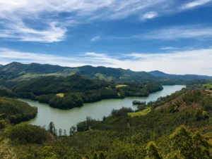
During quieter hours, the reflections across the reservoir create some of the most serene landscapes in the region.
Echo Point & Kundala Lake
Further ahead, the route passes through Echo Point and toward Kundala Lake, where the scenery becomes softer and more expansive. The road narrows through forests and plantation curves, often revealing sudden panoramic openings across the valleys.
Kundala’s still waters and surrounding hills offer a slower pace compared to central Munnar, making it one of the more peaceful sections of the route.
Top Station
Near the Kerala-Tamil Nadu border, the landscape changes dramatically as the road climbs toward Top Station. On clear days, the viewpoint reveals sweeping views across the plains of Tamil Nadu far below the Western Ghats.
But the real character of Top Station is often found in its changing weather, moving clouds, cool winds, and moments where the valleys disappear entirely beneath mist.
The journey itself becomes more important than the viewpoint.
Vattavada
Beyond Top Station, the road gradually enters Vattavada, a high-altitude farming region known for vegetable cultivation, fruit orchards, and quieter village landscapes rarely associated with mainstream Munnar tourism.
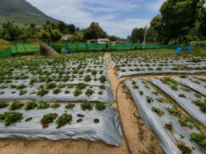
Compared to the busier sections near town, Vattavada feels slower, more rural, and deeply connected to the rhythms of the mountains. Terraced farms, narrow roads, and changing weather patterns create a very different experience from the tea-centric image of Munnar.
For travellers seeking slower journeys, photography, or longer highland stays, this corridor offers one of the most atmospheric sides of Kerala’s mountains.
The Cultural & Ecological Side of Munnar
Marayoor – Kanthalloor – Chinnar
While many visitors associate Munnar with cool weather and tea estates, the route toward Marayoor and Chinnar reveals an entirely different landscape, one shaped by dry forests, ancient trade paths, tribal history, and ecological transition zones between Kerala and Tamil Nadu.
As the road descends away from Munnar’s mist-covered hills, the environment slowly transforms. Tea plantations begin to disappear, replaced by rocky terrain, open valleys, sandalwood forests, and drier mountain ecosystems that feel vastly different from central Munnar.
This route is one of the most diverse and culturally layered journeys in Kerala’s high ranges.
Rajamalai & Eravikulam Region
The route initially passes through the Rajamalai region, home to montane grasslands and protected high-altitude ecosystems associated with the Eravikulam landscape. These elevated habitats support unique biodiversity and form part of the fragile ecological structure of the Western Ghats.
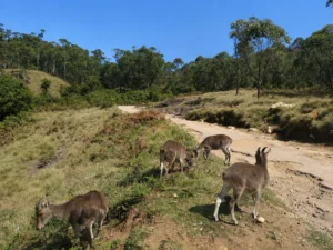
Rajamalai is also one of the most important habitats of the Nilgiri Tahr, an endangered mountain ungulate endemic to the Western Ghats. Often seen navigating steep grass-covered slopes and rocky escarpments, the Nilgiri Tahr has become one of the defining ecological symbols of Munnar’s high ranges.
The protected grassland ecosystems around Eravikulam National Park play a critical role in sustaining its remaining wild populations.
During certain seasons, the hills become wrapped in mist and moving grassland shadows, creating one of the most dramatic mountain environments in South India.
Marayoor
Further ahead lies Marayoor, a region known for its sandalwood forests, sugarcane cultivation, and long-standing cultural identity. Unlike the plantation-dominated landscapes around Munnar, Marayoor carries a more rugged and earthy atmosphere.
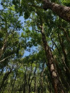
The area is also associated with ancient dolmens and archaeological remains believed to date back thousands of years, adding a historical dimension to the landscape.
Traditional jaggery production continues to be an important part of local life here, and the villages around Marayoor retain a quieter pace rarely found in heavily commercialised hill stations.
Kanthalloor
Near the Tamil Nadu border, Kanthalloor introduces a completely different visual landscape shaped by orchards, terraced farming, and cooler dry-climate agriculture. Apple cultivation, strawberry farms, vegetables, and seasonal produce have given the region a distinctive agricultural identity within Kerala.
The roads around Kanthalloor feel less like a tourist circuit and more like a remote mountain farming belt, surrounded by open skies and changing terrain.
Chinnar Wildlife Sanctuary
Further toward the eastern side of the high ranges lies Chinnar Wildlife Sanctuary, one of the most ecologically distinct protected regions in Kerala. Unlike the wet evergreen forests commonly associated with the Western Ghats, Chinnar is known for its dry thorn forests, riparian ecosystems, and rain-shadow geography.
The sanctuary supports diverse wildlife, including elephants, gaur, langurs, deer, and numerous bird species adapted to the region’s dry ecological conditions.
More than a conventional sightseeing destination, Chinnar represents a transition landscape, where climate, vegetation, and cultural influences begin shifting toward the eastern plains.
For travellers interested in ecology, slower exploration, landscape diversity, and cultural depth, this corridor offers one of the most rewarding journeys around Munnar.
Tea Heritage & Plantation Landscapes
The Nallathanni Route
The Nallathanni corridor offers a gentler and more accessible side of Munnar, centred around tea heritage, plantation history, and the landscapes that shaped the region’s colonial-era identity.
Unlike the more remote or rugged routes around Munnar, this stretch remains closely connected to the town itself, making it ideal for travellers seeking a slower introduction to the high ranges without venturing too far into the surrounding mountain corridors.
The route is characterised by rolling tea gardens, old plantation roads, cool weather, and layered views across the valleys.
Tea Estates & Plantation Culture
Tea plantations are deeply woven into the identity of Munnar. Across the Nallathanni region, neatly contoured tea fields spread across hillsides that were transformed during the colonial plantation period.
Beyond their visual appeal, these estates also represent the historical evolution of labour, migration, and plantation economies within Kerala’s high ranges.
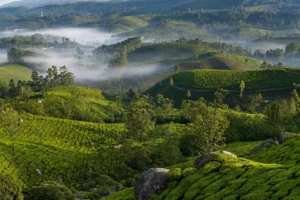
Early mornings often reveal workers moving through the slopes beneath drifting mist, creating some of the most recognisable scenes associated with Munnar.
Tea Museum
One of the defining stops along this route is the Tea Museum, which provides insight into the region’s tea-growing legacy and the industrial processes behind plantation production.
The museum traces the development of tea cultivation in the hills, including machinery, processing techniques, and the transformation of Munnar into one of South India’s most important tea-producing regions.
For travellers interested in landscape history rather than only sightseeing, this section adds important context to the visual environment surrounding Munnar.
Blossom Park & Nearby Landscapes
The route also passes through softer recreational landscapes including parks, forest edges, and quieter plantation roads suited for relaxed walks and shorter explorations.
Compared to the dramatic mountain viewpoints of other routes, the Nallathanni corridor feels calmer and more intimate — defined less by spectacle and more by atmosphere.
For families, first-time visitors, and travellers interested in plantation heritage, this remains one of the most approachable sides of Munnar.
Forest Edge Villages & Elephant Landscapes
The Anakulam Route
The route toward Anakulam reveals one of the quieter and lesser-explored landscapes surrounding Munnar. Unlike the heavily visited tourist corridors near Top Station or Mattupetty, this side of the high ranges feels more rural, forested, and ecologically connected to the surrounding hills.
The road passes through smaller settlements, plantation stretches, river crossings, and forest-edge villages where the pace of travel slows considerably.
Anachal & Rural Highland Landscapes
The initial stretch through Anachal introduces a softer transition away from central Munnar. Tea estates gradually give way to mixed vegetation, village roads, and more dispersed landscapes shaped by farming and forest proximity.
Compared to the more commercialised sections of Munnar, this corridor retains a quieter atmosphere with fewer large tourist concentrations.
Anakulam
Anakulam is widely associated with elephant movement zones, particularly during seasons when herds descend toward water sources near the village.
Surrounded by forests and river systems, the area offers a very different experience from the plantation-heavy image commonly associated with Munnar. The landscape feels more ecological than touristic, shaped by wildlife movement, terrain, and natural rhythms.
Rather than functioning as a conventional sightseeing destination, Anakulam is better experienced slowly, with attention to its environmental sensitivity and quieter atmosphere.
For travellers seeking offbeat highland experiences, slower village landscapes, and forest-edge environments, this route offers one of the more understated sides of Munnar.
The Scenic Highland Route Toward Kerala’s Spice Country
Devikulam – Pooppara – Thekkady Corridor
The route extending from Devikulam toward Pooppara and onward to Thekkady forms one of the most scenic transit corridors across Kerala’s high ranges. Rather than serving as a standalone sightseeing route, this road connects mountain landscapes, plantation valleys, lakes, waterfalls, and spice-growing regions into a continuous highland journey.
It is one of the most rewarding ways to experience the gradual geographical transition between Munnar’s tea country and Kerala’s spice belt.
Devikulam
Located just outside Munnar, Devikulam is known for its cooler climate, rolling hills, and quieter landscapes. The surrounding region is defined by tea estates, mist-covered slopes, and elevated viewpoints overlooking the valleys below.
Compared to the busier tourist areas around central Munnar, Devikulam often feels calmer and more residential in character.
Waterfalls & Highland Reservoirs
As the road continues toward Pooppara, the landscape becomes increasingly dramatic with waterfalls, forest stretches, and large water reservoirs appearing between plantation valleys.
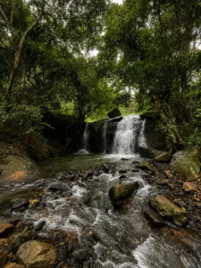
Hidden within these forested slopes, Marachuvadu Waterfalls flows through shaded woodland terrain, offering a quieter and less commercial mountain stop closely connected to the natural ecosystem of the Western Ghats.
The Anayirankal Dam region introduces expansive lake scenery framed by tea-covered hills and drifting mountain clouds, creating one of the most photogenic sections of the route.
Pooppara & Transition Landscapes
Near Pooppara, the terrain begins shifting again as the road moves gradually toward spice-growing regions connected to Thekkady and Kumily.
Cardamom plantations, changing vegetation, and wider valley systems begin replacing the tighter tea-covered slopes associated with Munnar.
This gradual environmental transition is what makes the corridor particularly rewarding for slow road journeys.
For travellers combining Munnar with Thekkady (Periyar Tiger Reserve) or Kerala’s spice regions, this route offers far more than simple transportation, it becomes an integral part of the larger highland travel experience.
The Theni Road: Hidden Highlands, Reservoir Landscapes & Border Villages
While many visitors remain within central Munnar, the road towards Theni reveals a quieter and more layered side of the highlands. This route moves through mist-covered valleys, lesser-known viewpoints, waterfalls, reservoir systems, and border villages that gradually connect Kerala with Tamil Nadu’s hill landscapes.
One of the early highlights is Devikulam, a serene hill settlement surrounded by rolling grasslands and tea estates. The cool climate, eucalyptus groves, and panoramic valley views create a slower and more contemplative atmosphere compared to the busier tourist circuits.
Further along the route, travellers encounter hidden viewpoints overlooking forested valleys and cloud-covered mountain ridges. During monsoon and post-monsoon months, several seasonal waterfalls appear along the roadside, creating dramatic landscapes ideal for photography and scenic stops.
The road also passes near the Anayirankal Dam region, known for its reservoir views framed by tea plantations and elephant corridors. Early mornings often reveal floating mist over the water, while evenings bring soft golden light across the surrounding hills.
As the journey continues, the route gradually approaches Pooppara and the Tamil Nadu border regions. From here, one road leads toward Kumily and Thekkady, while another descends toward Theni in Tamil Nadu. This makes the Theni route particularly valuable for travellers combining Munnar with Periyar, Madurai, or extended South India journeys.
Compared to Munnar’s more commercial stretches, this route offers a more open and atmospheric experience shaped by forests, reservoirs, mountain agriculture, and cross-cultural highland settlements.
Best Experiences to Include in a Munnar Journey
Munnar is often associated with tea plantations, but the destination offers a much wider range of experiences when explored thoughtfully. The surrounding routes, villages, forests, and highland communities create opportunities for deeper cultural and nature-based travel.
Tea Estate Walks & Plantation Experiences
Visitors can explore working tea estates, learn about cultivation and processing, and experience the rhythms of plantation life that shaped Munnar’s identity.
Sunrise & Viewpoint Drives
Early morning drives toward Top Station, Lockhart Gap, or remote valley viewpoints offer dramatic mountain light, mist-covered ridges, and panoramic photography opportunities.
Village & Agricultural Encounters
Regions like Vattavada and Kanthalloor introduce travellers to high-altitude farming communities producing strawberries, vegetables, garlic, passion fruit, and traditional crops rarely associated with Kerala.
Wildlife & Nature Experiences
Protected landscapes around Rajamalai, Chinnar, and Anaikulam create opportunities for wildlife observation, birdwatching, forest drives, and guided eco-tourism activities.
Slow Travel & Wellness
Munnar’s cool climate and mountain landscapes make it ideal for wellness-focused travel, including plantation stays, forest retreats, yoga programs, and Ayurvedic experiences.
Local Food & Highland Cuisine
Travellers can experience Kerala highland cuisine influenced by both Kerala and Tamil traditions, including locally grown spices, fresh produce, village cooking, and plantation-inspired meals.
How Many Days Are Ideal for Munnar?
Many travellers allocate only one or two nights for Munnar, but the destination becomes significantly more rewarding with slower exploration.
2 Nights / 3 Days
Suitable for:
- Tea plantations
- Mattupetty circuit
- Short sightseeing
- Relaxed resort stay
3 Nights / 4 Days
Ideal for:
- Multiple scenic routes
- Rajamalai or Chinnar
- Village experiences
- Photography and slow travel
4–5 Nights
Recommended for:
- Nature-focused travellers
- Wellness retreats
- Birdwatching and eco-tourism
- Deep exploration of remote regions like Vattavada and Kanthalloor
- Combining Munnar with Thekkady or Tamil Nadu highlands
For travellers seeking meaningful experiences rather than checklist tourism, Munnar rewards slower journeys that move beyond crowded viewpoints into landscapes shaped by ecology, agriculture, and mountain culture.
When Is the Best Time to Visit Munnar?
Munnar can be visited throughout the year, but each season offers a different experience.
October to March – Peak Season
Cool weather, clear skies, and comfortable temperatures make this the most popular period for sightseeing and outdoor experiences.
April to May – Summer Escape
While much of South India experiences intense heat, Munnar remains comparatively cool and pleasant, making it ideal for mountain retreats.
June to September – Monsoon Season
Monsoon transforms the landscape into deep green valleys with mist-covered mountains, waterfalls, and dramatic cloud formations. This season is particularly attractive for photographers, slow travellers, and monsoon enthusiasts.
Travellers should note that visibility during monsoon can change rapidly, and some outdoor activities may be weather dependent.
Planning a Kerala Itinerary with Munnar
Munnar works best as part of a larger Kerala journey rather than an isolated destination. Its mountain landscapes contrast beautifully with Kerala’s backwaters, forests, coastal regions, and cultural centres.
A well-designed Kerala itinerary may combine:
- Kochi’s heritage districts
- Munnar’s tea-covered highlands
- Thekkady’s forests and wildlife
- Kumarakom or Alleppey backwaters
- Slow village experiences and wellness stays
For travellers seeking a more immersive journey, Munnar can also be connected with Tamil Nadu highland regions through routes leading toward Theni and Madurai.
If you are planning a longer journey through Kerala, explore our detailed:
10-Day Kerala Itinerary for Nature, Culture & Slow Travel Experiences
Closing
Munnar is far more than a hill station built around tea plantations. The destination unfolds through its roads, each leading toward different landscapes, communities, ecosystems, and experiences.
From the lakes and viewpoints of the Mattupetty route to the forests of Chinnar, the agricultural valleys of Vattavada, the quieter stretches toward Anaikulam, and the reservoir landscapes along the Theni road, Munnar offers multiple journeys within a single destination.
Travellers who move beyond the standard sightseeing circuit often discover a richer highland experience shaped by ecology, culture, slow travel, and regional diversity.
Rather than rushing through viewpoints, the best way to experience Munnar is to explore its routes slowly, allowing the mountains, forests, villages, and changing landscapes to define the journey itself.
Related Blogs
Thanjavur Beyond Brihadeeswara Temple: Exploring the Cultural Heart of the Cauvery Delta
More Than a Temple City For many travellers, Thanjavur begins and ends with Brihadeeswara Temple. The soaring vimana, vast courtyards,…
Read More ›
Kanchipuram: Sacred Architecture and Living Traditions
More Than the City of a Thousand Temples Kanchipuram is often introduced as the “City of a Thousand Temples.” While…
Read More ›